
Β· 2 min read
Daniel Hermon

πŸ“„ TL;DR​

Introducing a new service in raster. New exciting features in the catalog app! Overall improvements and bug fixes.

πŸš€ Features​

Raster​

Overview​

Overall Raster tiles serving, ingestion and export.

General​

  • All services moved to David's Fortress Site.
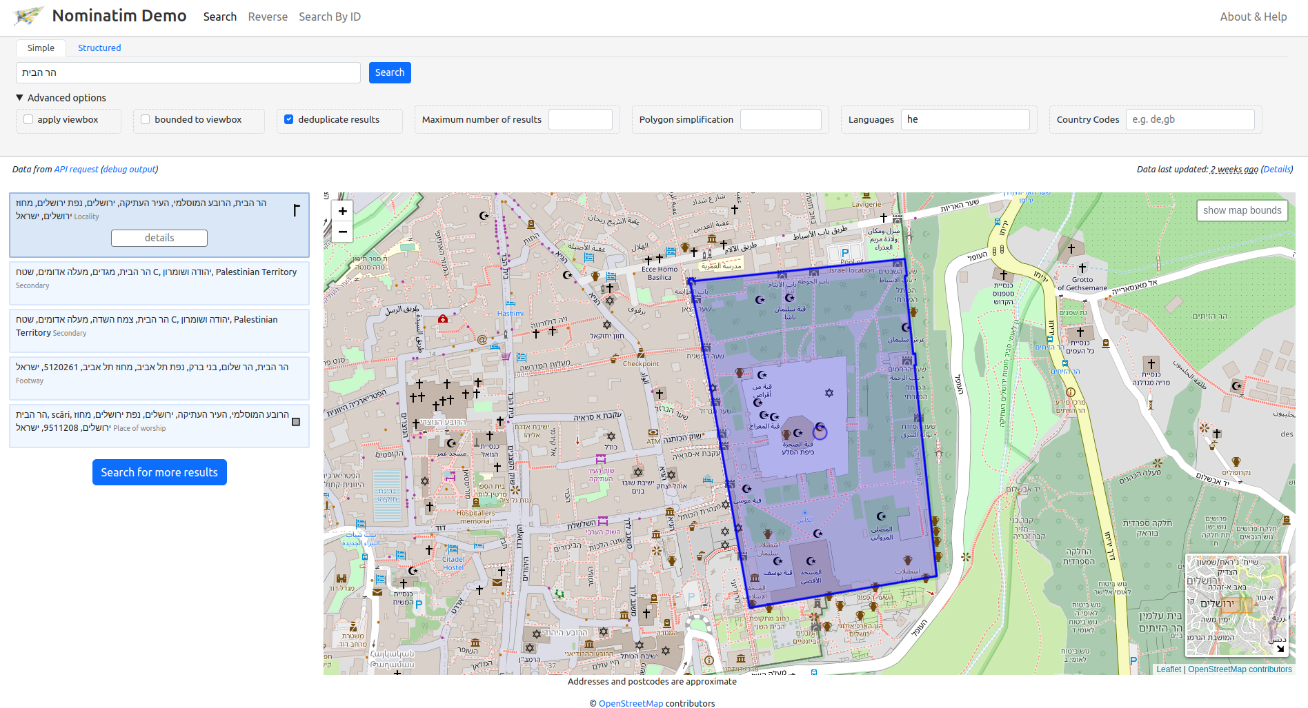
Catalog Service​

Catalog Profile Update​

Additions:

  • mc:links - will also include a link for KVP version of WMTS.

Tile Serving (β€œMap Server”)​

General features​

Caching and monitoring improvements.

  • Serving 3D Tiles via http2

Export Service (activated via Catalog App in manager mode)​

Via the catalog app, catalog managers can now export a multi-resolution GPKG for offline usage.

Known Bugs πŸžβ€‹

  1. GetCapabilities shows the wrong extent of the layer.

  2. There is up to 5 minutes delay between a layer presented in the catalog to be available for consumption via the tile server.

3D​

3D
  • Overall improvements in serving 3D tiles.
  • Serving 3D Tiles via http2

Vector​

vector_team_logo

Query Service​

  • Overall improvements in Query Service performance.
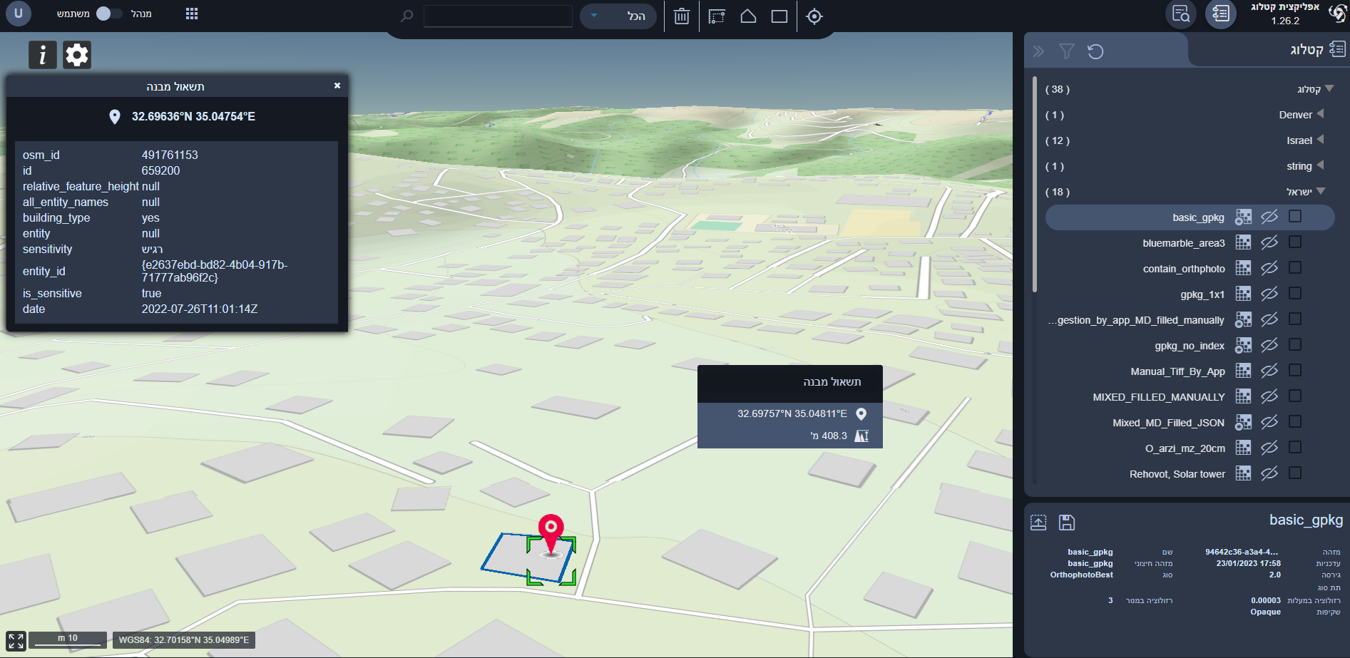
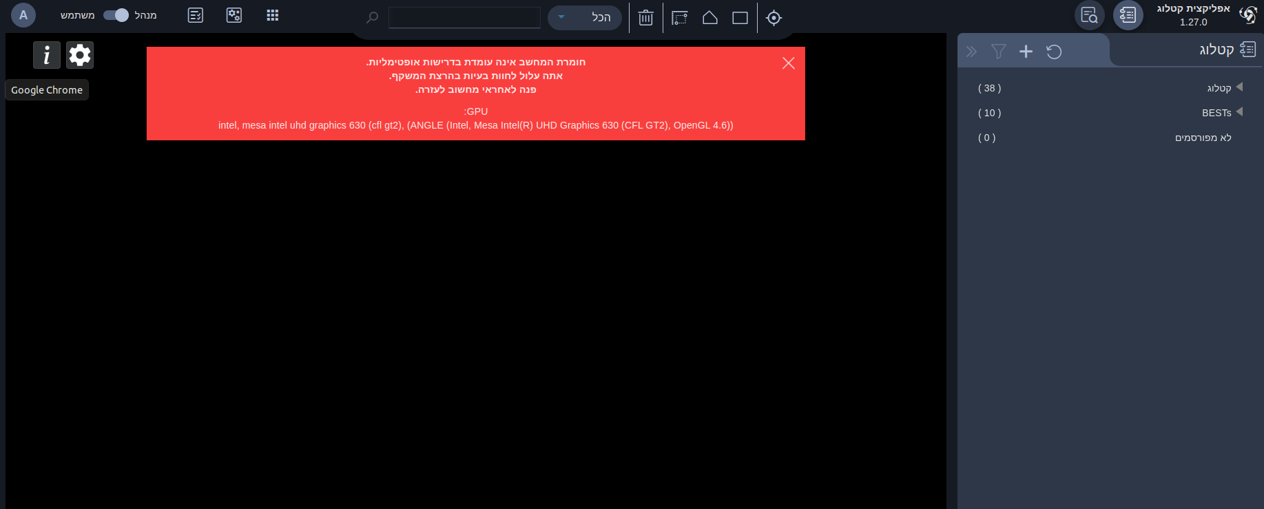
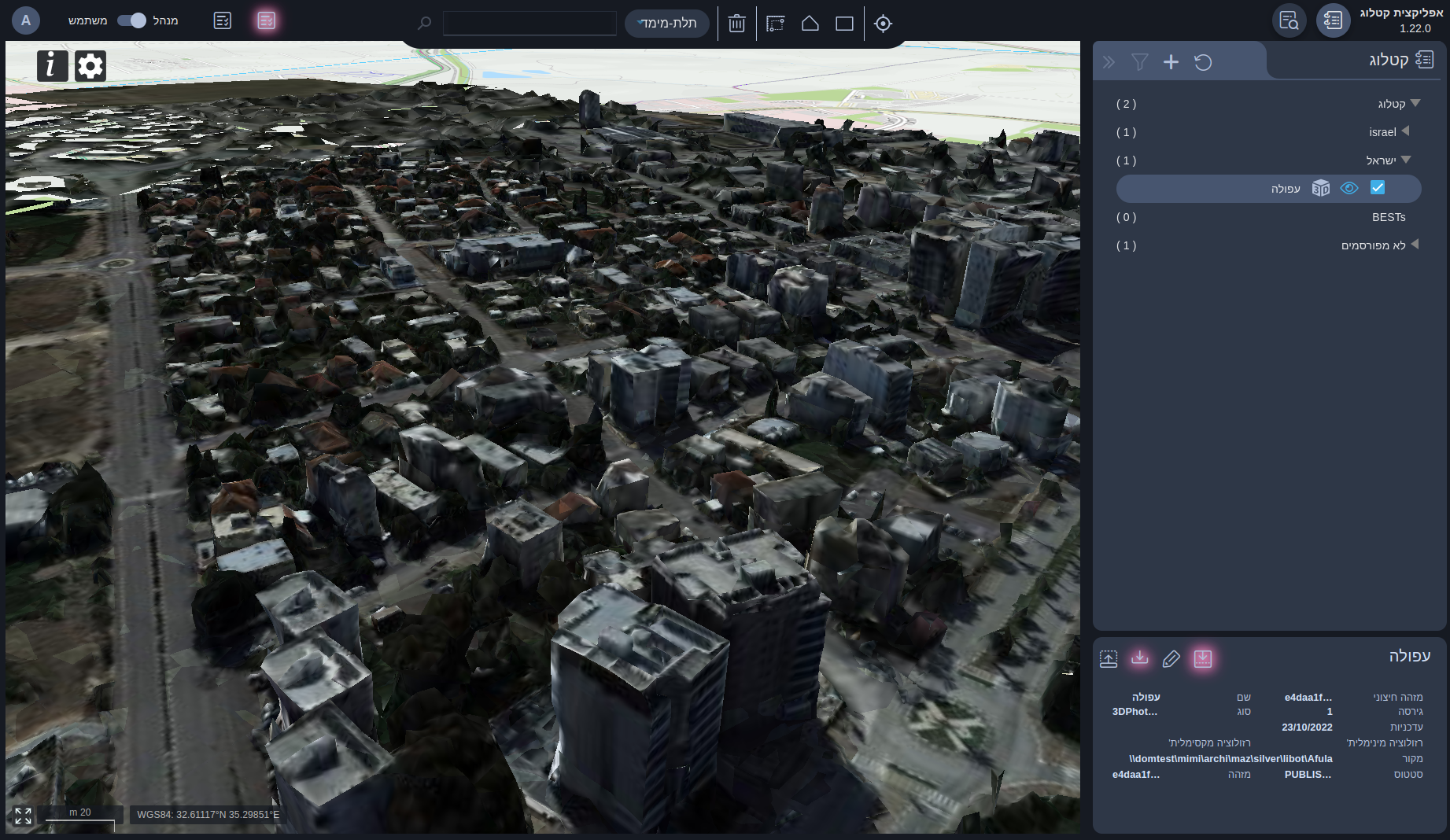
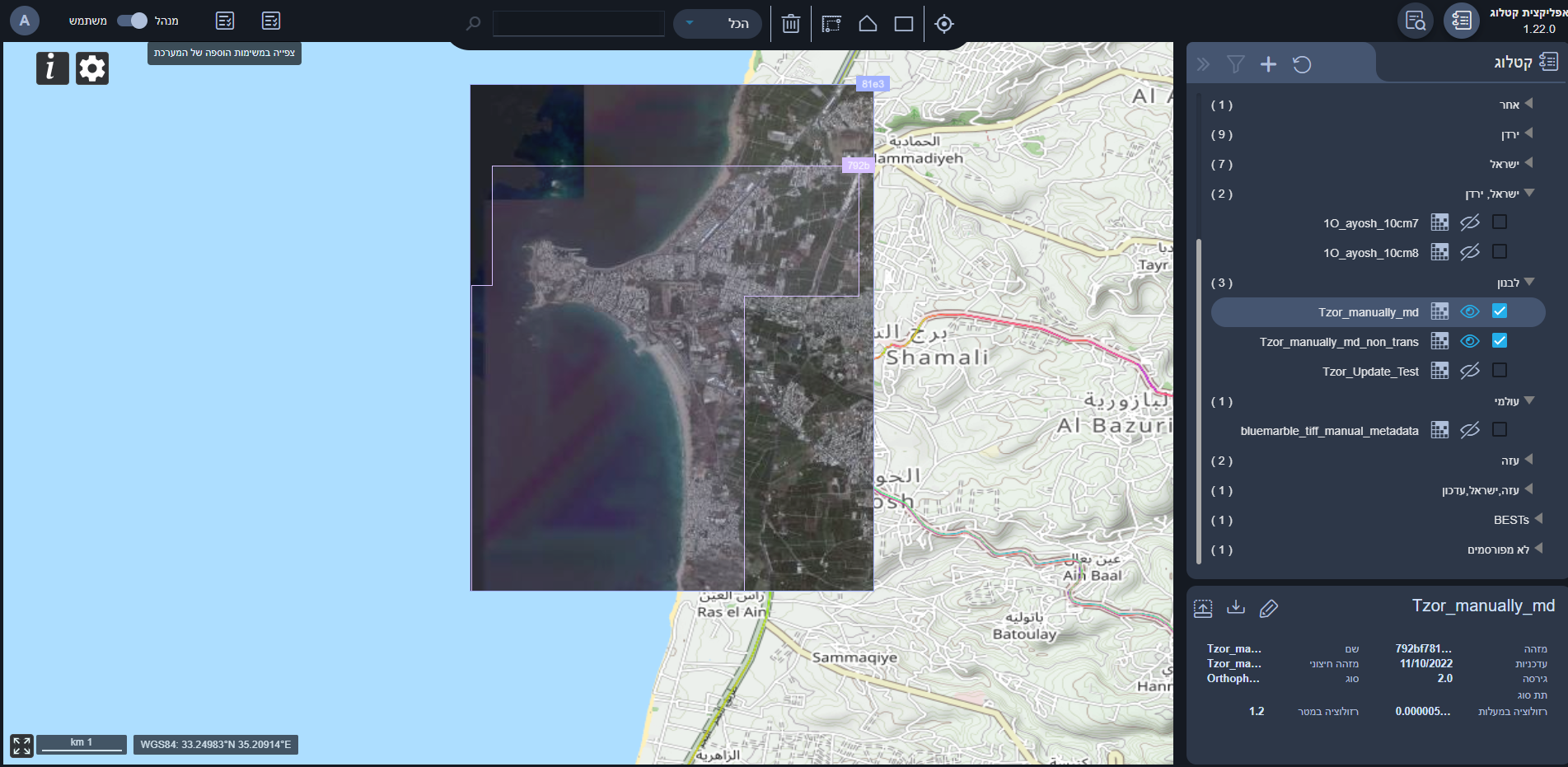
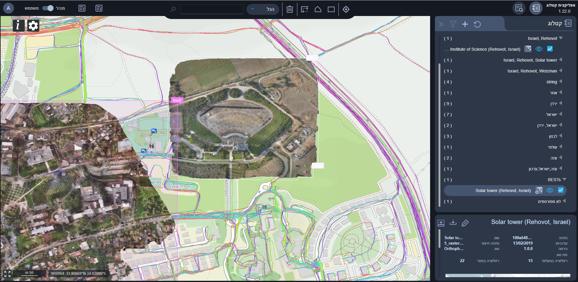
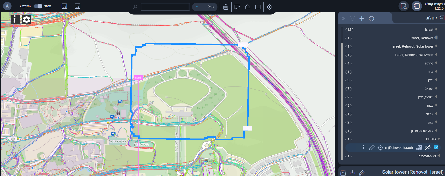
Catalog App​

  • General improvements of the UI \ UX

  • Added support for data export services

  • KVP Capabilities added in layer metadata

  • Added Multi-domain export principles. Currently supported raster’s multi-resolution export

    multi-res-export
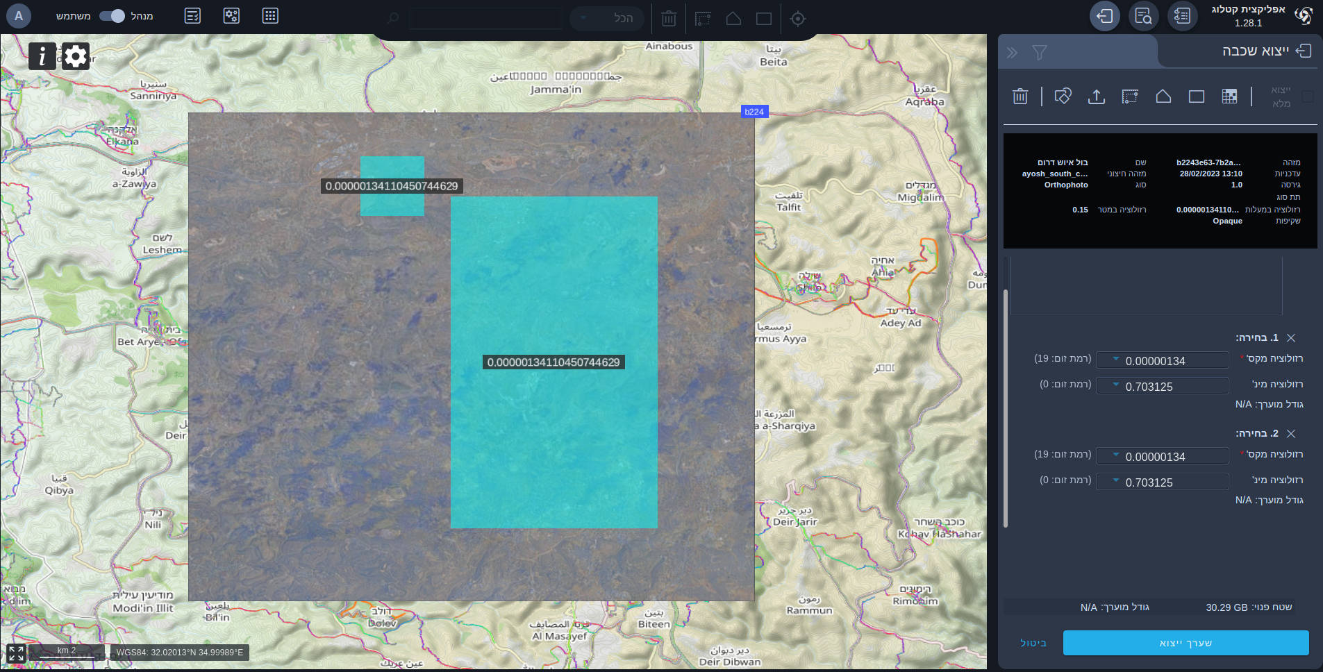
    • While defining multi-resolution/parts export, available following options for part definition
      • By drawing rectangle
        app_view
      • By drawing polygon
        app_view
      • By entering a coordinates of exported rectangle
        app_view
      • By uploading SHAPE/GeoJson file
        app_view
      • By selecting predefined AOI
        app_view
    • Each export part will have estimated size
    • Exported artifact will have total estimated size as well
    • Available disk space info
  • Tiles for covered layers are not requested (performance oriented and configurable)

  • Job manager shows links to exported artifacts
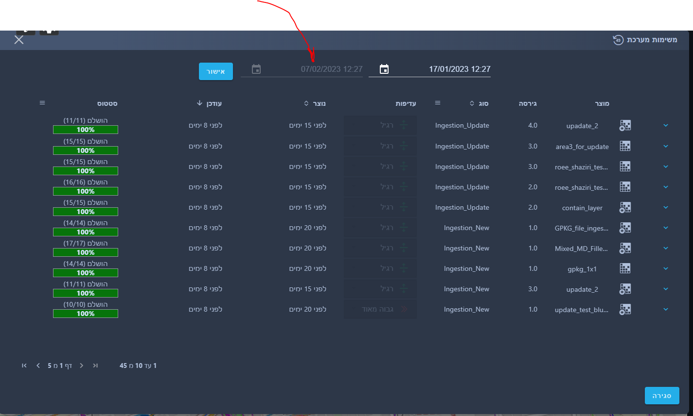
Products Management​

Ingestion:

  • Improved logs
  • Prevention of ingesting non EPSG4326 data

Known Bugs πŸžβ€‹

  1. Some jobs gets timeout (large GPKGs)

Β· 5 min read
Daniel Hermon

πŸ“„ TL;DR​

Introducing new services in raster, vector. New exciting features in the catalog app! Overall improvements and bug fixes.

πŸš€ Features​

Raster​

Overview​

In addition to complete solution for raster product’s consumption. A few major features where introduced in the new version.

Catalog Service​

Catalog Profile Update​

Additions:

  • transparency - indicates whether a raster layer has transparency

Removals:

  • WMTS_LAYER field removed from record's Links

New available layers:​

wmts_logo
  1. β€œBestβ€œ layer was updated to latest data in JPEG format
  2. β€œDigital Mapβ€œ update
  3. β€œOSMβ€œ layer - a civilian OSM map, for more info click here

Tile Serving (β€œMap Server”)​

General features​

Caching and monitoring improvements.

Ingestion Service (activated via Catalog App in manager mode)​

  1. A full ingestion solution was added for new products for new materials with various raw data formats (j2k, tiff, GPKG).
  2. A partial solution for β€œupdating” existing catalog layers data (currently GPKG only).

Export Service​

Solution for creating raster β€œofflineβ€œ products is now available. (Via API for users with a valid export token) The API supports a webhook when the job finished.

Known Bugs πŸžβ€‹

  1. GetCapabilities shows the wrong extent of the layer.

  2. There is up to 5 minutes delay between a layer presented in the catalog to be available for consumption via the tile server.

3D​

3D
  • Overall improvements in serving 3D tiles.

Overview​

Optimal, complete, easy, efficient, and robust solution for raster product consumption is now available. Just start by querying the catalog for the desired product and set your map component up in no time.

Catalog Service​

You are now able to search, and filter all the available 3D photorealistic models in your cloud environment via CSW protocol. Refer to the profile of the 3D records here

Tile Serving Service​

You are now able to consume 3D tiles (b3dm) via the tile serving service in a tile layer (β€œXYZ”) protocol. Check here for a step-by-step tutorial.

Vector​

vector_team_logo

Query Service​

This new service provides facilities for searching and retrieving feature data from vector layers. buildings layer is now available to query. Vector query service uses the WFS protocol which is a READ-ONLY Web Feature Service. We provide three actions to query the layers:

  • GetCapabilities - returns full capabilities provided by the service.

  • DescribeFeatureType - description of a feature type.

  • GetFeature - the request returns a collection of geographic feature instances filtered according to criteria set by the requesting client.

refer to Query Service.

OpenStreetMap Carto (OSM)​

In this version, can be consumed OpenStreetMap Carto like our other Rasterized Vector products (as a part of Digital Map).

OpenStreetMap Carto (OSM Carto for short) is an open-source stylesheet for rendering OpenStreetMap data to raster tiles.

As this stylesheet is open-source, we had to make a few minor changes compared to the original one:

  1. We changed the stylesheet projection from Web Mercator to WGS84.

  2. We modified the database insertion script to prefer names in Hebrew and English when possible.

  3. We imported data from the Natural Earth dataset in places where we didn't import OSM data.

refer to OpenStreetMap Carto.

Nominatim​

Nominatim (from the Latin, 'by name') is a tool to search OpenStreetMap data by name and address (geocoding) and to generate synthetic addresses of OSM points (reverse geocoding).

In addition to the API, we brought Nominatim UI. Nominatim UI offers a small website for trying Nominatim and inspecting the database content.

refer to Nominatim.

nominatim_search_he

Catalog App​

  • General improvements of the UI \ UX

    • Components redesign
    • New fonts and icons
    • Better error reporting
    • Fly-to 3D model changes automatically map-view to 3D mode
  • Added Vector’s query service in order to visualize an entity and show the details

    app_view
  • New tools suite site is now available via the app

  • The app checks for the availability of graphics hardware acceleration (for more info visit here)

    app_view

Web tools​

The terrain verification tool is exposed as part of the MapColonies WEB tools suite

app_view

Products Management​

  • Discrete values are now selected from a dropdown instead of free text input.
  • You can now stop / resume jobs from the UI.
  • You can now update a rater layer via the UI
  • Job management screen shows jobs from defined date till NOW
app_view

Fixed Bugs πŸžβœ”οΈβ€‹

Job Management:

  1. The refresh button makes the job’s progress disappear.
  2. Job progress won’t update with new data when the dialog is open.

MISC:​

  1. Backend errors aren't prompted properly to the client.
  2. Special characters support in metadata external ID field.
  3. When opening the file browser in the ingestion form, it messes up the app’s styles. (Refreshing the app helps).
  4. When searching an area on the map for products, update any field from the product’s metadata and then select edit again, the selected metadata will be the old one.

Known Bugs 🐞 βŒβ€‹

  1. 3D footprints are not clamped to terrain.

Β· 3 min read
Daniel Hermon

πŸ“„ TL;DR​

Production-ready release, ready for integration and going live. Mainly focused on tile streaming services and catalog services.

πŸš€ Features​

Raster​

wmts_logo

Overview​

Optimal, complete, easy, efficient, and robust solution for raster product consumption is now available. Just start by querying the catalog for the desired product and set your map component up in no time.

Catalog Service​

You are now able to search, and filter all the available raster products in your cloud environment via CSW protocol. Refer to the profile of the raster records here

Tile Serving Service (β€œMap Server”)​

You are now able to consume raster tiles via the tile serving service in the WMTS protocol. Check here for a step-by-step tutorial.

Known Bugs πŸžβ€‹

GetCapabilities shows the wrong extent of the layer.

There is up to 5 minutes delay between a layer presented in the catalog to be available for consumption via the tile server.

3D​

3D

Overview​

Optimal, complete, easy, efficient, and robust solution for raster product consumption is now available. Just start by querying the catalog for the desired product and set your map component up in no time.

Catalog Service​

You are now able to search, and filter all the available 3D photorealistic models in your cloud environment via CSW protocol. Refer to the profile of the 3D records here

Tile Serving Service​

You are now able to consume 3D tiles (b3dm) via the tile serving service in a tile layer (β€œXYZ”) protocol. Check here for a step-by-step tutorial.

Vector​

In this version, we present a new service and rasterized vector products.

replication

Replication Service​

This new service allows you to replicate vector layers to your environment including keeping track of changes along the timeline, as of the day of the release the buildings layer is now available for consumption. refer to here.

Digital Map Rasterized Vector Products​

In this version, we introduce several rasterized vector products.

  • Base map - a simple non-transparent basic overlay for your maps. the map continuously updates with the latest changes.

  • Control Map - the famous universal control language map.

Catalog App​

Overview​

The catalog app is now live, and the web application allows you to view, search and filter 3D, Raster, and Vector products.

app_viewapp_viewapp_viewapp_view

Products Management​

For admin users, the products management view is now available. You are able to edit the metadata of products.

Known Bugs πŸžβ€‹

Job Management:

  1. The refresh button makes the job’s progress disappear.
  2. Job progress won’t update with new data when the dialog is open.

MISC:

  1. Backend errors aren't prompted properly to the client.
  2. Special characters support in metadata external ID field.
  3. When opening the file browser in the ingestion form, it messes up the app’s styles. (Refreshing the app helps).
  4. When searching an area on the map for products, update any field from the product’s metadata and then select edit again, the selected metadata will be the old one.